


Voting District 21585, Contra Costa County, California
About
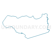
Outline

Summary
| Unique Area Identifier | 529820 |
| Name | Voting District 21585 |
| County | Contra Costa County |
| State | California |
| Area (square miles) | 0.37 |
| Land Area (square miles) | 0.37 |
| Water Area (square miles) | 0.00 |
| % of Land Area | 100.00 |
| % of Water Area | 0.00 |
| Latitude of the Internal Point | 37.80309350 |
| Longtitude of the Internal Point | -122.07159350 |
Maps


Graphs
Select a template below for downloading or customizing gragh for Voting District 21585, Contra Costa County, California


Neighbors
Neighoring Voting District (by Name) Neighboring Voting District on the Map
- Voting District 21470, Contra Costa County, CA
- Voting District 31815, Contra Costa County, CA
- Voting District 32505, Contra Costa County, CA
- Voting District 41240, Alameda County, CA
- Voting District 41300, Alameda County, CA
Top 10 Neighboring County Subdivision (by Population) Neighboring County Subdivision on the Map
- Central Contra Costa CCD, Contra Costa County, CA (471,183)
- Hayward CCD, Alameda County, CA (366,577)
Top 10 Neighboring Elementary School District (by Population) Neighboring Elementary School District on the Map
Top 10 Neighboring Secondary School District (by Population) Neighboring Secondary School District on the Map
Top 10 Neighboring Unified School District (by Population) Neighboring Unified School District on the Map
- San Ramon Valley Unified School District, CA (143,385)
- Castro Valley Unified School District, CA (49,397)
Top 10 Neighboring State Legislative District Lower Chamber (by Population) Neighboring State Legislative District Lower Chamber on the Map
- Assembly District 15, CA (591,194)
- Assembly District 18, CA (452,969)
- Assembly District 14, CA (445,394)
Top 10 Neighboring State Legislative District Upper Chamber (by Population) Neighboring State Legislative District Upper Chamber on the Map
Top 10 Neighboring 111th Congressional District (by Population) Neighboring 111th Congressional District on the Map
Top 10 Neighboring Census Tract (by Population) Neighboring Census Tract on the Map
- Census Tract 3452.03, Contra Costa County, CA (6,472)
- Census Tract 3521.02, Contra Costa County, CA (5,586)
- Census Tract 4301.02, Alameda County, CA (2,285)